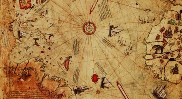
First world map was drawn by Piri Reis who was the senior sailor of Ottoman navy. It wasn’t an ordinary map because it has some points to find out on it. Thus many researches are being made on this map.
Piri Reis prepared this map in 1513. That was the period when western sailing developed. New world (American continent) had just discovered and many new islands on oceans were dominated by western sailors. Despite of those developments, they weren’t ready to prepare a world map.
Ottoman Empire charged Piri Reis to make a development against this position. He was the expert on sailing. He prepared this map in four years and he came up before Ottoman Sultan in 1513.
This map has some mysteries such as the structures of the continents. None of them were unearthed till we have a satellite technology.
